Community input remains an important part of the process. The public comment period will be open from April 20 through May 15, 2026. Please provide your comments here.
You need to be signed in to comment in this Guest Book.
You need to be signed in to comment in this Guest Book. Click here to Sign In or Register to get involved
The ATP does an excellent job of creating a network of Class IV or protected bike lanes on both major arterials and collector streets such as Escuela. The cutsheets in Appendix B are very helpful showing the potential progression from existing to resurfacing and reconstruction. This is a strength of the ATP.
The Existing Conditions report for the ATP was excellent. As other commenters have noted, it should be included as an Appendix. There should be a whold section discussion how these finding were incorporated into the ATP recommendations.
I appreciate the work done in identifying Class IIIB Bicycle Boulevards in Appendix B. However, I'm dispappointed that there didn't appear to upgrade the definition of a bicycle boulevard similar to Bryant St. In Palo Alto. This upgraded version of bicycle boulevard is very cost effective, make bicycles a priority, and generates significant bicycle usage. The last Bicycle Plan had a recommendation for a Montecito Bicycle Blvd. This should be used as a foundation that would connect the Mountain View Caltrain station to the San Antonio stations. The neighborhoods in between would be well served by an upgraed bicycle boulevard.
The 30 improvements to crossings in Appendix C respond well to public comments on the subject. Prioritiized mid-block crossing and intersection improvements should be incorporated into Figure 27, Prioritized Projects. While the City of Mountain View has done an excellent job of providing accessible curb cuts for wheelchair, the implementation of accessible pedestrain signals for low vision individuals is spotty. Within a mile of my townshouse, there are about 40% of signalized intersections without accessible pedestrain signals. This should be addressed as a priority. I would suggest adding a section on Crossing to the Recommendations chapter.
Regional connectivity is important to increasing bicycle usage. Connections to bicycle networks in Palo Alto, Sunnyvale and Los Altos should be highlighted. There are gaps that are being addressed, such as the Evelyn corridor. Regional connectivity is not adequately addressed.
I would like to recommend severa; policy additions. First is making no parking in Class II bike lanes an official policy. As discussed extensively at both BPAC and the CTC, the part-time bike lanes on Middlefiled Rd. are a safety hazard. I live in townhouse that abuts Middlefield Rd and have experienced several near miss accidents as I had to swerve into speeding traffic lanes to avoid parkied cars in the evenings and weekends. I have recevently observed a teenager on an e-bike swerving into a traffic lane in another neear mise.
A second policy is adopting the NACTO Urban Bikeway Guide as the official standards guide for the Ctiy of Mountain View. It has been vetted extensively by other cities.
A third policy adoption would be consider Green Complete Street for all Class IV facilities during early planning process. As discussed at the CTC, adopting a Green Street Checklist would be an importnat first step in making serious consideration during early planning and before funding is secured.
Finally, there needs to be aspiration mode split goals in the ATP. There is discussion of what the existing mode shares are for commute trips and school trips. Based on a peer analysis of what is possible, the ATP should establish aspirational goals of what percertage of all trips are biking and wlaking. After all, the ATP recommendations are meant to increase biking and walking. It should be clear what aspirational objectives we are working towards as we invest in significant bicycle and pedestrian infrastructure.
Cliff3769
3 months ago
Many neighbors around Sylvan Ave are opposed to the proposed 'improvements' outlined in the Draft Transportation plan for Sylvan Ave. Currently, we have one car lane going in each direction with bike lanes, sidewalks and parking on both sides of Sylvan (parking is allowed along most of Sylvan Ave). Should the 'improvements' be implemented to widen the sidewalks to provide more protection for bike lanes, it appears that we would most likely lose parking along Sylvan Ave. With the new 22 unit housing development (that includes no visitor parking in its plans) breaking ground on one end of Sylvan Ave and apartments and duplexes lining Sylvan on the other end of Sylvan Ave, we would not want to lose street parking. A great improvement: New slower 25 mph speed limit signs have been posted along Sylvan Ave within the last month which should make everyone safer
Lani T
3 months ago
It always feels weird to constantly punt on projects are Caltrans ROW. I completely understand why. But those road are core parts of our city, often the most highly trafficked, often intersecting with all the projects on this list, often the highest on the injury network. I'd love to see the following:
- If Caltrans is going to initiate work on something on our list, or something that was bumped from our list, I'd love to see it move up in priority. - If we are going to work on something that might have Caltrans ROW, we should initiate communication with them as early as possible. And maybe show Caltrans response to the public.
Overall, I do see the acknowledgement of which projects intersect with Caltrans ROW. That is fantastic. However, I'd like to more transparency as to what will be done about it. What steps are we taking to be proactive? What is Caltrains response to our proactivity? If they aren't responding, are there channels the city can use to escalate?
emilabraham
3 months ago
False/misleading statement about El Camino bikelanes: on the bottom of page 49 (can't copy text from document -- this should be fixed in the final plan so that it can be easily referenced) there is a statement about bike lanes being "implemented" and the only remaining work being improving connectivity along El Camino. But the bike lanes simply disappear at several intersections, forcing bikes to merge into a car lane in this major arterial. This is a serious hazard. It's as if a freeway was built, except every couple of miles, the freeway merges with an airport runway, but the plan for future freeways says "we already built that freeway." This needs to be fixed to say that protected bikelanes were partially implemented but that gaps remain at key intersections.
ladamic
3 months ago
We have to take mode shift for Mountain View seriously. With active transportation modes prioritized. Think climate change. Think health. Think actually being out in your community. I want our city to look forward, not in the rear view mirror at the status quo. We already have plenty of that!
bkengland
3 months ago
The ATP should include a much clearer public record of the technical work, background analysis, and prioritization process that informed the plan. Key supporting documents should be appended to the final ATP so residents can understand how the final recommendations were developed.
In particular, the ATP should append the 2023 ATP Existing Conditions and Needs Summary. The ATP scope included a review of City Code and Standard Details in Task 2: Background Review, and the findings were presented to BPAC in October 2023. This was part of the ATP’s core background work, not a separate or unrelated analysis.
The Existing Conditions and Needs Summary specifically identified implementation barriers in the City’s Standard Details. On page 43, the report states that Standard Details A-1 through A-9 define typical street cross sections and are used as the starting point for street elements such as travel lanes, bike lanes, and sidewalks, but that “the current standards do not reflect streets that support active transportation for all ages and abilities.”
This is directly relevant to ATP implementation. If the City’s adopted Standard Details do not reflect streets that support active transportation for all ages and abilities, that finding should not be separated from the final ATP materials or difficult for the public to find.
Right now, finding the Existing Conditions and Needs Summary requires looking through Legistar, identifying the correct BPAC meeting, and then opening the correct report within that meeting packet. That is not a reasonable or transparent way for residents to access a key technical document that informed the ATP. This report used to be available from the ATP website, but appears to have been removed from the page or is no longer clearly linked after the latest ATP webpage update on April 20, 2026.
The City should also append AccessMV to the ATP. AccessMV provides much more detail about the project selection criteria, prioritization methodology, and background assumptions used to evaluate active transportation needs. Including it as an appendix would help the public understand not just what projects are listed in the ATP, but how those projects were selected, scored, and prioritized.
This is especially important because several public comments are asking for more clarity on implementation standards, facility types, school access, daylighting, bike boulevard design, and resurfacing/restriping decisions. Residents should be able to trace the final recommendations back to the analysis, criteria, and public input that shaped them.
A plan this important should not require residents to piece together the technical basis from scattered meeting packets, draft reports, and separate documents. The final ATP should include these materials as appendices, with clear links on the ATP project page, so the public can understand the full basis for the recommendations and hold the City accountable for implementation.
thank you for this. 1. I am surprised daylighting options are poorly discussed. They are an extremely cheap method of increasing pedestrian safety and slowing cars down beyond what is in this report. Lots of options from simple reflectors added to the ground, to plastic bollards, to rubber barriers all the way to concrete extensions of sidewalks. We saw how helpful this was where caltrans adjusted turning radiuses when they redid the curbs along el camino. crossing streets while walking down el camino is much safer. Please add in more options. Every single sidewalk/road project should include why daylighting was not added. 2. I am surprised you did not include a heat map of "near misses" reported to AskMV. At Hans/Bonita, near Bubb, we have near misses once a week...and while there haven't been incidents, surely, over 5 years, you can see what has been called in. This map would take 30 mins to generate from all the near-miss data the city has been recording. 3. Lastly, there's no mention of removing parking from just one side of the street. On a street like Hans, where only 5 houses face the south side of the street, you could easily remove parking on one side and reshape the road for two way biking. There's plenty of space for those houses to park on the other side. The council is adamant that we build housing with not enough parking, so surely, nobody should assume they have a right to a parking spot in front of their house and they would agree, that if we could get more people biking (kids), we would require less biking. 4. We should really prioritize routes to schools within .5 miles of a school. An inordinate amount of traffic is generated shuttling hundreds of kids 1 mile away....and parents returning back home to Work from Home. 5. I thought Begen at Cuesta was supposed to get an improved crossing?
sundarpichai
3 months ago
The PDF doesn't allow for selection of text. If this is a document setting vs. a problem on my end, it makes it difficult to quote sections in order to give feedback.
ladamic
3 months ago
Bots: The ATP needs to have clear guidelines and criteria for use of pedestrian and bicycle facilities by automated delivery bots. Unlike driving, where vehicles are substantially expected to move in the same way and along a strict path whether human or AI driven, walking and biking have greater variability in speed and space needs. Bots, even when not being outright hazards (though sometimes they can be), can make walking and biking less enjoyable to human users by impeding free movement or forcing humans to circumnavigate them. The city needs to spell out how it will evaluate the impact of bots on use of these preciously constructed facilities to ensure that their primary purpose is not adversely affected/undermined for profit. And no, "bots can share data" is not a substitute for "bots will not substantially degrade the utility and appeal of the facilities for humans".
ladamic
3 months ago
Per appendix B, long-term I hope the city prioritizes full street reconstruction projects over resurfacing projects, since these projects (1) provide for more permanent, higher quality infrastructure (2) provide more separation distance and visibility between bikes and vehicles and (3) makes it so the city can deliver on sustainable green infrastructure rather than relying so much on plastics that degrade.
I don't see definitions for classes of bike lane in the document, which may be key for defining some of these projects. For example, when our current "class 3 bike routes" north of Central expressway are converted to "Class 3B bike boulevards" what should that entail? Will there be modal filters? Similarly, why is Stierlin planned to be a bike boulevard when it has bike lanes already and why wouldn't a Class IV bikeway be provided instead? It's hard to tell what would happen in these cases without definitions and standards.
The ATP should identify more long-term potential corridors that go through R3 so that Paseos line up and can be used as transportation, instead of just as apartment access.
Additionally, we need an answer for where and how bike routes will flow through and/or around downtown. We have so many routes going into this area (Moffett, Stierlin, South Castro, California, etc) but without a plan for where the bikes are supposed to go, we are left either breaking the law by using the ped mall, or riding on very high-stress routes with many cars. The city needs to commit to allowing bikes through the ped mall in a safe, orderly fashion, or, barring that, to provide a low-stress AAA parallel alternative.
There needs to be better bike/ped access from San Antonio Caltrain into the Del Medio neighborhood, utilizing the overpass so that bikes and peds don't have to cross at San Antonio and California. This includes (1) sidewalk completion so that people can walk to Del Medio without crossing the street multiple times and (2) a real bike lane or cycletrack to avoid conflict with vehicles. The station area also needs a speed limit reduction due to the high pedestrian traffic and amount of loading/unloading that occurs here.
Daniel
3 months ago
In considering "walkability", please, discuss having driveways be level with existing sidewalks. Requiring new construction to provide level access would be a start. Aged residents and residents with impaired ambulation have a difficult time walking along uneven sidewalks. Thank you.
Pam73
3 months ago
Active living and transport starts with childhood. The city should ensure that children within a certain radius from schools have a safe and active way to school. This includes: 1. Clearly marked and protected bike lanes. Especially on streets where the school is actually located. 2. Traffic calming in school catchments, including the use of dividers and plantations. 3. Conveniently located and clearly visible parking for bikes near schools.
VikV
3 months ago
As a teacher at Los Altos and sponsor for the Green Team I'm surprised I didn't hear about outreach to students during this process. Many Mountain View students bike to Los Altos and their routes are often quite dangerous to cyclists.
SPvarsitypark
3 months ago
We need to have progress reported out yearly to council and BPAC. Currently it is taking decades to complete each project and it feels like many years have no projects completed.
SPvarsitypark
3 months ago
We absolutely need this!
There are kids who actively bike these roads to/from school. Having seen the improvements made on California st, el Camino real and seeing what better looks like- we need to make more of these bike routes safer
nikheel
3 months ago
Overall I'm very excited and happy MV is adding bike lanes and improving pedestrian areas. We need more fully protected bike lanes, especially on any roads with more than 2 lanes or speed limits higher than 25mph. I would not send my kids on their bikes on any street that did not have protected (or separated) bike lanes and low speed limits.
This plan needs to be paired with traffic calming, red light cameras and speeding cameras. California has a reckless driving epidemic and another way to improve biking and walking for residents is to reduce speeding and traffic law violations.
We also need more mixed use and dense housing to increase the utilization of these new bike lanes and sidewalks. The more people we have riding and walking, the better our overall safety will be.
Thank you!
Ryan
3 months ago
re: Projects, looks like some intersections are missing ; Rengstorff/ECR, Showers/ECR. San Antonio/ECR all important routes to school and that would most likely have scored high if considered. re: Programs/Policies - Would have liked to see programs promoting biking and walking to all in the community. For biking, leverage/promote Bike to Work/Wherever events, For walking, start Walktober events as many other communities do. Enforce policies that would close sidewalk gaps: with new building or remodel, get landowner to build sidewalk if none present AND close sidewalk cuts when a driveway is no longer utilized (for instance by Cuesta Park in front of the Annex)

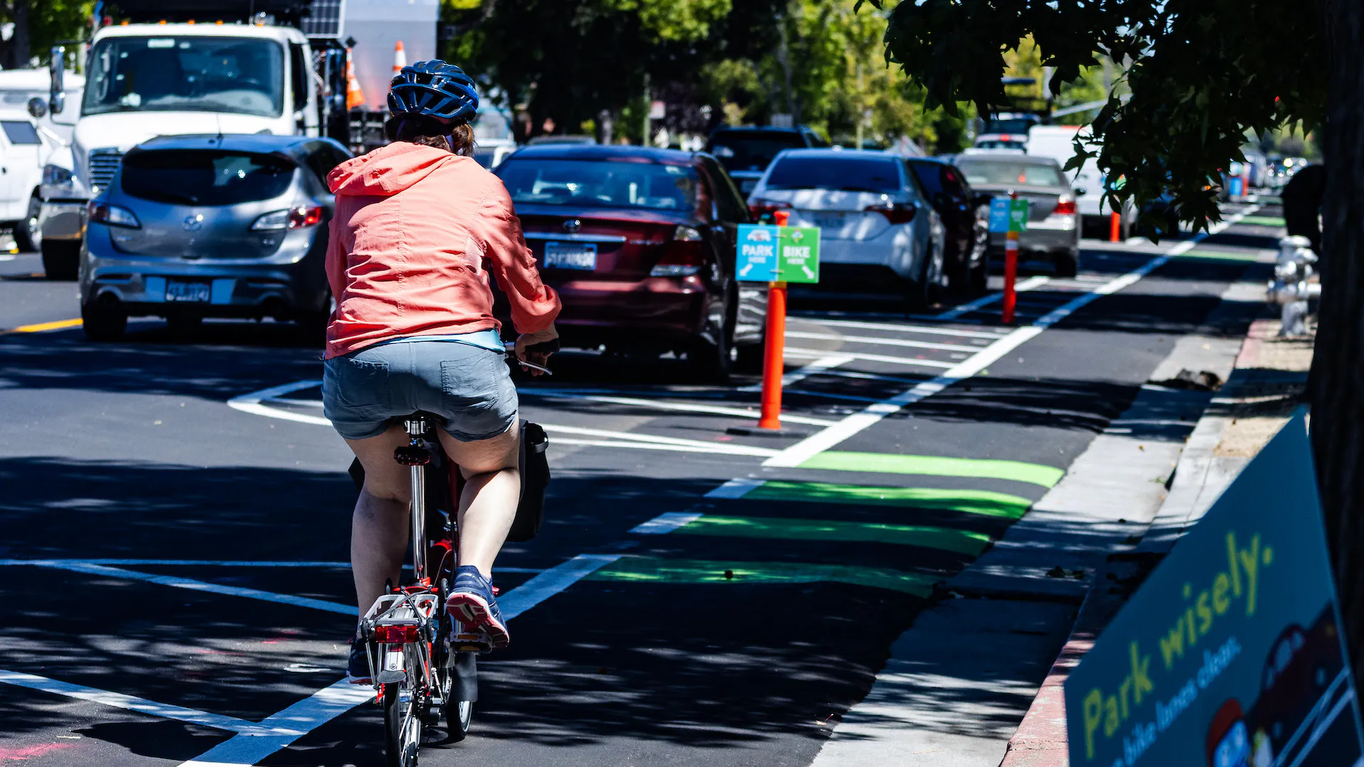
The ATP does an excellent job of creating a network of Class IV or protected bike lanes on both major arterials and collector streets such as Escuela. The cutsheets in Appendix B are very helpful showing the potential progression from existing to resurfacing and reconstruction. This is a strength of the ATP.
The Existing Conditions report for the ATP was excellent. As other commenters have noted, it should be included as an Appendix. There should be a whold section discussion how these finding were incorporated into the ATP recommendations.
I appreciate the work done in identifying Class IIIB Bicycle Boulevards in Appendix B. However, I'm dispappointed that there didn't appear to upgrade the definition of a bicycle boulevard similar to Bryant St. In Palo Alto. This upgraded version of bicycle boulevard is very cost effective, make bicycles a priority, and generates significant bicycle usage. The last Bicycle Plan had a recommendation for a Montecito Bicycle Blvd. This should be used as a foundation that would connect the Mountain View Caltrain station to the San Antonio stations. The neighborhoods in between would be well served by an upgraed bicycle boulevard.
The 30 improvements to crossings in Appendix C respond well to public comments on the subject. Prioritiized mid-block crossing and intersection improvements should be incorporated into Figure 27, Prioritized Projects. While the City of Mountain View has done an excellent job of providing accessible curb cuts for wheelchair, the implementation of accessible pedestrain signals for low vision individuals is spotty. Within a mile of my townshouse, there are about 40% of signalized intersections without accessible pedestrain signals. This should be addressed as a priority. I would suggest adding a section on Crossing to the Recommendations chapter.
Regional connectivity is important to increasing bicycle usage. Connections to bicycle networks in Palo Alto, Sunnyvale and Los Altos should be highlighted. There are gaps that are being addressed, such as the Evelyn corridor. Regional connectivity is not adequately addressed.
I would like to recommend severa; policy additions. First is making no parking in Class II bike lanes an official policy. As discussed extensively at both BPAC and the CTC, the part-time bike lanes on Middlefiled Rd. are a safety hazard. I live in townhouse that abuts Middlefield Rd and have experienced several near miss accidents as I had to swerve into speeding traffic lanes to avoid parkied cars in the evenings and weekends. I have recevently observed a teenager on an e-bike swerving into a traffic lane in another neear mise.
A second policy is adopting the NACTO Urban Bikeway Guide as the official standards guide for the Ctiy of Mountain View. It has been vetted extensively by other cities.
A third policy adoption would be consider Green Complete Street for all Class IV facilities during early planning process. As discussed at the CTC, adopting a Green Street Checklist would be an importnat first step in making serious consideration during early planning and before funding is secured.
Finally, there needs to be aspiration mode split goals in the ATP. There is discussion of what the existing mode shares are for commute trips and school trips. Based on a peer analysis of what is possible, the ATP should establish aspirational goals of what percertage of all trips are biking and wlaking. After all, the ATP recommendations are meant to increase biking and walking. It should be clear what aspirational objectives we are working towards as we invest in significant bicycle and pedestrian infrastructure.
Many neighbors around Sylvan Ave are opposed to the proposed 'improvements' outlined in the Draft Transportation plan for Sylvan Ave. Currently, we have one car lane going in each direction with bike lanes, sidewalks and parking on both sides of Sylvan (parking is allowed along most of Sylvan Ave). Should the 'improvements' be implemented to widen the sidewalks to provide more protection for bike lanes, it appears that we would most likely lose parking along Sylvan Ave. With the new 22 unit housing development (that includes no visitor parking in its plans) breaking ground on one end of Sylvan Ave and apartments and duplexes lining Sylvan on the other end of Sylvan Ave, we would not want to lose street parking. A great improvement: New slower 25 mph speed limit signs have been posted along Sylvan Ave within the last month which should make everyone safer
It always feels weird to constantly punt on projects are Caltrans ROW. I completely understand why. But those road are core parts of our city, often the most highly trafficked, often intersecting with all the projects on this list, often the highest on the injury network. I'd love to see the following:
- If Caltrans is going to initiate work on something on our list, or something that was bumped from our list, I'd love to see it move up in priority.
- If we are going to work on something that might have Caltrans ROW, we should initiate communication with them as early as possible. And maybe show Caltrans response to the public.
Overall, I do see the acknowledgement of which projects intersect with Caltrans ROW. That is fantastic. However, I'd like to more transparency as to what will be done about it. What steps are we taking to be proactive? What is Caltrains response to our proactivity? If they aren't responding, are there channels the city can use to escalate?
False/misleading statement about El Camino bikelanes: on the bottom of page 49 (can't copy text from document -- this should be fixed in the final plan so that it can be easily referenced) there is a statement about bike lanes being "implemented" and the only remaining work being improving connectivity along El Camino. But the bike lanes simply disappear at several intersections, forcing bikes to merge into a car lane in this major arterial. This is a serious hazard. It's as if a freeway was built, except every couple of miles, the freeway merges with an airport runway, but the plan for future freeways says "we already built that freeway." This needs to be fixed to say that protected bikelanes were partially implemented but that gaps remain at key intersections.
We have to take mode shift for Mountain View seriously. With active transportation modes prioritized. Think climate change. Think health. Think actually being out in your community. I want our city to look forward, not in the rear view mirror at the status quo. We already have plenty of that!
The ATP should include a much clearer public record of the technical work, background analysis, and prioritization process that informed the plan. Key supporting documents should be appended to the final ATP so residents can understand how the final recommendations were developed.
In particular, the ATP should append the 2023 ATP Existing Conditions and Needs Summary. The ATP scope included a review of City Code and Standard Details in Task 2: Background Review, and the findings were presented to BPAC in October 2023. This was part of the ATP’s core background work, not a separate or unrelated analysis.
The Existing Conditions and Needs Summary specifically identified implementation barriers in the City’s Standard Details. On page 43, the report states that Standard Details A-1 through A-9 define typical street cross sections and are used as the starting point for street elements such as travel lanes, bike lanes, and sidewalks, but that “the current standards do not reflect streets that support active transportation for all ages and abilities.”
This is directly relevant to ATP implementation. If the City’s adopted Standard Details do not reflect streets that support active transportation for all ages and abilities, that finding should not be separated from the final ATP materials or difficult for the public to find.
Right now, finding the Existing Conditions and Needs Summary requires looking through Legistar, identifying the correct BPAC meeting, and then opening the correct report within that meeting packet. That is not a reasonable or transparent way for residents to access a key technical document that informed the ATP. This report used to be available from the ATP website, but appears to have been removed from the page or is no longer clearly linked after the latest ATP webpage update on April 20, 2026.
The City should also append AccessMV to the ATP. AccessMV provides much more detail about the project selection criteria, prioritization methodology, and background assumptions used to evaluate active transportation needs. Including it as an appendix would help the public understand not just what projects are listed in the ATP, but how those projects were selected, scored, and prioritized.
This is especially important because several public comments are asking for more clarity on implementation standards, facility types, school access, daylighting, bike boulevard design, and resurfacing/restriping decisions. Residents should be able to trace the final recommendations back to the analysis, criteria, and public input that shaped them.
A plan this important should not require residents to piece together the technical basis from scattered meeting packets, draft reports, and separate documents. The final ATP should include these materials as appendices, with clear links on the ATP project page, so the public can understand the full basis for the recommendations and hold the City accountable for implementation.
References:
* ATP scope: https://mountainview.legistar.com/View.ashx?M=F&ID=10908111&GUID=D1F3DBDA-D14A-406F-B6DC-B29874C37949
* 2023 ATP Existing Conditions and Needs Summary: https://mountainview.legistar.com/View.ashx?M=F&ID=12388506&GUID=1A66C25B-8DF3-48FB-AA8D-A40A6EA16A9A
* Standard Details: https://developmentpermits.mountainview.gov/home/showpublisheddocument/2612/639120237004270000
* AccessMV: https://mountainview.legistar.com/View.ashx?M=F&ID=9422505&GUID=85ED06B9-ADDB-4EB2-98E7-93B6DE838EC1
Removed by moderator.
thank you for this.
1. I am surprised daylighting options are poorly discussed. They are an extremely cheap method of increasing pedestrian safety and slowing cars down beyond what is in this report. Lots of options from simple reflectors added to the ground, to plastic bollards, to rubber barriers all the way to concrete extensions of sidewalks. We saw how helpful this was where caltrans adjusted turning radiuses when they redid the curbs along el camino. crossing streets while walking down el camino is much safer. Please add in more options. Every single sidewalk/road project should include why daylighting was not added.
2. I am surprised you did not include a heat map of "near misses" reported to AskMV. At Hans/Bonita, near Bubb, we have near misses once a week...and while there haven't been incidents, surely, over 5 years, you can see what has been called in. This map would take 30 mins to generate from all the near-miss data the city has been recording.
3. Lastly, there's no mention of removing parking from just one side of the street. On a street like Hans, where only 5 houses face the south side of the street, you could easily remove parking on one side and reshape the road for two way biking. There's plenty of space for those houses to park on the other side. The council is adamant that we build housing with not enough parking, so surely, nobody should assume they have a right to a parking spot in front of their house and they would agree, that if we could get more people biking (kids), we would require less biking.
4. We should really prioritize routes to schools within .5 miles of a school. An inordinate amount of traffic is generated shuttling hundreds of kids 1 mile away....and parents returning back home to Work from Home.
5. I thought Begen at Cuesta was supposed to get an improved crossing?
The PDF doesn't allow for selection of text. If this is a document setting vs. a problem on my end, it makes it difficult to quote sections in order to give feedback.
Bots: The ATP needs to have clear guidelines and criteria for use of pedestrian and bicycle facilities by automated delivery bots. Unlike driving, where vehicles are substantially expected to move in the same way and along a strict path whether human or AI driven, walking and biking have greater variability in speed and space needs. Bots, even when not being outright hazards (though sometimes they can be), can make walking and biking less enjoyable to human users by impeding free movement or forcing humans to circumnavigate them. The city needs to spell out how it will evaluate the impact of bots on use of these preciously constructed facilities to ensure that their primary purpose is not adversely affected/undermined for profit. And no, "bots can share data" is not a substitute for "bots will not substantially degrade the utility and appeal of the facilities for humans".
Per appendix B, long-term I hope the city prioritizes full street reconstruction projects over resurfacing projects, since these projects (1) provide for more permanent, higher quality infrastructure (2) provide more separation distance and visibility between bikes and vehicles and (3) makes it so the city can deliver on sustainable green infrastructure rather than relying so much on plastics that degrade.
I don't see definitions for classes of bike lane in the document, which may be key for defining some of these projects. For example, when our current "class 3 bike routes" north of Central expressway are converted to "Class 3B bike boulevards" what should that entail? Will there be modal filters? Similarly, why is Stierlin planned to be a bike boulevard when it has bike lanes already and why wouldn't a Class IV bikeway be provided instead? It's hard to tell what would happen in these cases without definitions and standards.
The ATP should identify more long-term potential corridors that go through R3 so that Paseos line up and can be used as transportation, instead of just as apartment access.
Additionally, we need an answer for where and how bike routes will flow through and/or around downtown. We have so many routes going into this area (Moffett, Stierlin, South Castro, California, etc) but without a plan for where the bikes are supposed to go, we are left either breaking the law by using the ped mall, or riding on very high-stress routes with many cars. The city needs to commit to allowing bikes through the ped mall in a safe, orderly fashion, or, barring that, to provide a low-stress AAA parallel alternative.
There needs to be better bike/ped access from San Antonio Caltrain into the Del Medio neighborhood, utilizing the overpass so that bikes and peds don't have to cross at San Antonio and California. This includes (1) sidewalk completion so that people can walk to Del Medio without crossing the street multiple times and (2) a real bike lane or cycletrack to avoid conflict with vehicles. The station area also needs a speed limit reduction due to the high pedestrian traffic and amount of loading/unloading that occurs here.
In considering "walkability", please, discuss having driveways be level with existing sidewalks. Requiring new construction to provide level access would be a start. Aged residents and residents with impaired ambulation have a difficult time walking along uneven sidewalks. Thank you.
Active living and transport starts with childhood. The city should ensure that children within a certain radius from schools have a safe and active way to school. This includes:
1. Clearly marked and protected bike lanes. Especially on streets where the school is actually located.
2. Traffic calming in school catchments, including the use of dividers and plantations.
3. Conveniently located and clearly visible parking for bikes near schools.
As a teacher at Los Altos and sponsor for the Green Team I'm surprised I didn't hear about outreach to students during this process. Many Mountain View students bike to Los Altos and their routes are often quite dangerous to cyclists.
We need to have progress reported out yearly to council and BPAC. Currently it is taking decades to complete each project and it feels like many years have no projects completed.
We absolutely need this!
There are kids who actively bike these roads to/from school. Having seen the improvements made on California st, el Camino real and seeing what better looks like- we need to make more of these bike routes safer
Overall I'm very excited and happy MV is adding bike lanes and improving pedestrian areas. We need more fully protected bike lanes, especially on any roads with more than 2 lanes or speed limits higher than 25mph. I would not send my kids on their bikes on any street that did not have protected (or separated) bike lanes and low speed limits.
This plan needs to be paired with traffic calming, red light cameras and speeding cameras. California has a reckless driving epidemic and another way to improve biking and walking for residents is to reduce speeding and traffic law violations.
We also need more mixed use and dense housing to increase the utilization of these new bike lanes and sidewalks. The more people we have riding and walking, the better our overall safety will be.
Thank you!
re: Projects, looks like some intersections are missing ; Rengstorff/ECR, Showers/ECR. San Antonio/ECR all important routes to school and that would most likely have scored high if considered.
re: Programs/Policies -
Would have liked to see programs promoting biking and walking to all in the community. For biking, leverage/promote Bike to Work/Wherever events, For walking, start Walktober events as many other communities do.
Enforce policies that would close sidewalk gaps: with new building or remodel, get landowner to build sidewalk if none present AND close sidewalk cuts when a driveway is no longer utilized (for instance by Cuesta Park in front of the Annex)